
Hope for a Hodophile
- nwriversphotograph
- Apr 30, 2021
- 4 min read

A Hodophile is one who loves travel, and with a special affinity for roads. Derived from an ancient Greek word pertaining to roads and journeys.

Maligne Lake, Icefields Parkway near Jasper Alberta.
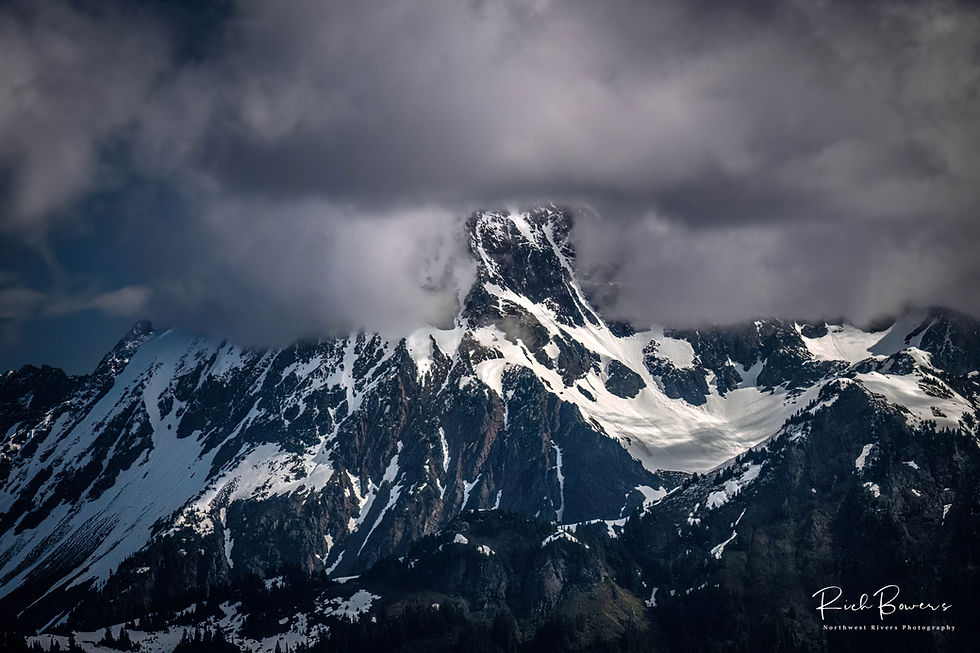
In my last blog, “Becoming One,” I said that driving in British Columbia (BC) seems like you are always in a National Park. There is reason for that since BC hosts seven National Parks, some 644 Provincial Parks, and claims that it has the highest proportion of protected land of any jurisdiction in the world (about 15% of BC is protected). After spending time there, I believe them. Today I expand on that earlier statement and take you on a photo road-trip headed east to Banff and Jasper National Parks (just over the border in Alberta), and describe how wonderful it is just to get to Canada’s Rocky Mountains.
It is about a ten-and-a-half-hour drive from Bellingham to Lake Louise. But in all honestly, I have never made it that quickly with all the amazing places and photo stops along the way. More realistic for me is about ten-plus hours to Revelstoke or Yoho National Park, which is at-best still some twenty minutes from the Continental Divide.

Bugaboo Falls, British Columbia.
All roads begin in Hope! Hope is a small town not far across the US border that sits at the confluence of the Fraser and Coquihalla rivers, and is the gateway to BC’s interior. In the past you could cross the border and drive to Hope in two hours, or you could fly into Vancouver BC and get there in about the same time. Remember you really cannot get into Canada now, and the latest update is that the border will remain closed at least until May 25th (most likely to be much longer).

Emerald Lake, Yoho National Park, British Columbia
From Hope you can take the southern Route 3 through Manning Provincial Park and BC’s prime agricultural region in the Upper Okanagan, to Rossland, up to Nelson, past the Bugaboo Mountains and Kootenay National Park, north to Mount Revelstoke National Park, through the Selkirk Mountains, then east to Yoho and then Lake Louise in Banff National Park. You can take Route 1 out of Hope to Kamloops, and then along Salmon Arm to Revelstoke. Or, from Kamloops you can take Route 5 North past Wells Grey Provincial Park, to Mount Robson (the highest peak in the Canadian Rockies at 12,972 feet) and into Jasper. All are equally wonderful to drive.

Kootenay National Park, British Columbia
Robson is the second highest point in BC, just short of Mount Waddington’s 13,186 feet over west in the Coast Range. Recommendation on the northern route -- plan to spend quality time in Wells Grey Park in the Cariboo Mountains, which is just phenomenal and home to forty-one named waterfalls including the 463-foot Helmcken Falls. In May and June, black bears can be easily seen along the road as they browse on new grasses. On my first trip many years ago, my daughter and I counted eight black bears in one campground. We quickly figured this was the bear’s campground and went to the people campground nearby! There are grizzlies here as well, but they usually stay in the far northern part of the park, or at elevation among the berries and wildflower meadows on Trophy Mountain.

Helmcken Falls, Wells Grey Provincial Park, British Columbia
Once on the divide, head north or south on Route 93, the Icefields Parkway, a seriously beautiful four-hour drive between Banff and Jasper National Parks. Banff, to the south, is Canada’s first National Park established in the 1880’s. It is one of the most scenic drives not just in Canada, but in the world. Hundreds of glaciers, waterfalls, emerald lakes, and wildlife. There is a lot of info on this drive, so I will not spend more time here, but note that you will want time to spend in and around Banff, in Jasper, and on the road linking them. You can do it in a day, but why would you?

Mountain Goats on Icefield Parkway, Alberta.
As in the US, National Parks can get crowded in the high season. Especially this summer when everyone is looking to escape the pandemic. If you do not like crowds, but like to drive, you can head twenty minutes east of Banff to Canmore and drive Route 742, the Smith Dorrien Trail through the Bow and Spray Valley Watersheds. It is a rough gravel road but should be passable without four-wheel drive, and it crosses the 6,250-foot elevation Smith Dorrien Pass – so not a good choice in winter. I drove it four mornings in a row and saw maybe two or three other cars each day – and tons of wildlife. A nice several hour loop is to take Route 742 south to Peter Lougheed Provincial Park, then Route 40 back to Canmore, with its wonderful local bars and restaurants.

Glacier fed Peyto Lake in Banff National Park. Alberta.
End Note
The Bow, Spray and Kananaskies Lakes area above were originally part of the Rocky Mountain Park of Canada. The National Parks Act of 1930 removed the Kananaskies area due to extensive fire damage, and twenty-one square miles along the Spray Lakes area due to water-power potential. BC is not unique at allowing dams to be built in beautiful places, think Glen Canyon Dam on the Colorado River, O’Shaughnessy Dam drowning the Tuolumne River outside Yosemite or the recently removed Elwha Dam in Olympic National Park. Calgary Power Company, now TransAlta Corporation, buried two lakes in the Bow River when they flooded the valley and began generation in 1950. The reservoirs and infrastructure are visible, although the drive, wildlife and solitude are still recommended.

Spray Lakes Reservoir Sunrise. Smith-Dorrien Trail, Alberta.


Comments